New miniaturized remote sensing instruments
Two parallel technical revolutions are underway, enabling a wide range of new remote-sensing applications. The first is in the miniaturization of remote-sensing instruments; the second is in the development of novel satellite and aircraft platforms and small, autonomous, highly mobile vehicles.
The need for affordable access to space and the growing availability of small satellites is driving this instrument miniaturization. Small satellites, ranging from 10 x 10 x 10 cm up to 1 m, are changing the paradigm of the way we do space. They are low cost, fast to manufacture, resilient, and easy to replace. A range of new commercial services and science missions are being developed to exploit these developments.
At the same time, new types of platforms for deploying small remote sensors are emerging. CubeSats and drones are being joined by HAPS (high-altitude pseudo-satellites). These are complemented on Earth by UUVs (unmanned underwater vehicles), ASVs (autonomous surface vehicles), and other platforms. This combination of smaller sensing systems and new deployment platforms is proving transformational.
The end applications and markets for space-based remote sensors are scientific research and the provision of commercial-information services which provide data and insight for defence, agriculture, insurance, energy, and other sectors.
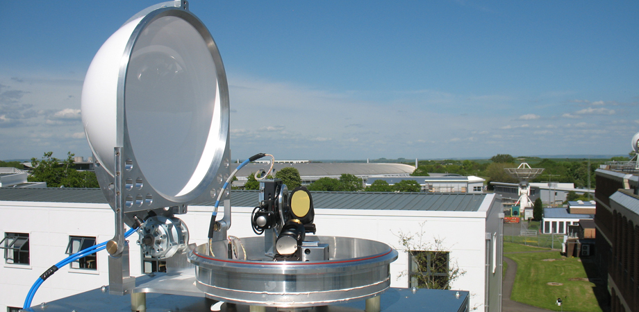
Remote-sensing instrument miniaturization
Several factors are driving remote-sensor miniaturization for space applications. The smaller size and lower mass of these remote-sensing instruments have a major impact on satellite launch costs, while reduced power requirements affect fuel consumption, mission life, and satellite design.
These benefits apply equally to airborne applications. Size and power reductions also are major benefits for land and marine platforms, enabling remote-sensor deployment in innovative applications and hostile environments.
Miniaturization: remote sensing instrument examples
Laser Heterodyne Radiometers
The Laser Heterodyne Radiometer (LHR) is an innovative, passive spectro-radiometer. It uses a low-power solid-state laser as a highly stable local oscillator, together with optical mixing using high-speed photodiodes, to observe the unique spectral signatures of atmospheric constituents and pollutants in the mid-infrared. Performance advantages are high sensitivity, high spectral resolution, and high spatial resolution combined with relatively low complexity.
This technology has potential for extreme miniaturization, enabling it to equal or exceed the performance of costly, heavy, bulky Fourier Transform Spectrometers normally used in these wavelength domains. Applications include environmental monitoring, security and defence, and industrial applications.
High-resolution Anthropogenic Pollution Imager (HAPI)
HAPI applies a novel approach called Discrete-Wavelength DOAS (DW-DOAS) to sensing atmospheric nitrogen dioxide (NO2), with 20-30 times fewer spectral channels than traditional hyperspectral imaging.
")
HAPI Breadboard with 10 optical channels. Credit: University of Leicester
The HAPI approach can easily be adapted for ground-based platforms due to highly simplified optics, especially when compared to traditional trace gas imagers. It can provide new insights into urban NO2 distrbibution and high-resolution identification of combustion point sources for both regulatory and defence-related monitoring of emissions.
Compact Infrared Imager and Radiometer (CIIR)
CIIR is a new approach to infrared sensing of Earth from space that can provide calibrated data over hours/years. Based on an uncooled bolometer, it uses two components to ensure high quality sensing: 1) a traceable radiometric calibration target to guarantee accuracy of <0.2K; and 2) an intermediate focus between the input telescope and detector array allowing a large (>10) number of discrete spectral channels to be used.
")
Compact Infrared Imager and Radiometer (CIIR) diagram showing optical path. Credit: University of Oxford
The wide range of potential commercial applications include agriculture and forestry, disaster management, environment, ecology and hydrology, geology, insurance, oil and gas, and aviation.
Miniaturization: enabling technologies
Phase Change Cells for Next Generation InfraRed Calibration Sources (NGenIRS)
To achieve the most precise measurements from infrared instruments, an on-board blackbody calibration system is required. Instruments requiring this include satellite, airborne, and field sensors for atmospheric and surface measurements; commercially available infrared cameras; future military and security surveillance systems; and future infrared remote sensing. For space applications, there is massive downward pressure on the mass, power, and volume of these calibration bodies to enable deployment on smaller, cheaper satellite missions.
Measuring the temperature of the internal radiating surface of the on-board blackbody is critical to achieving high accuracy. This is achieved by embedding a miniature phase-change cell in the blackbody structure next to the temperature sensors. The cell will absorb and release heat during the phase change, maintaining a constant temperature and enabling the thermometer to be calibrated in-situ.
The phase-change cell is a robust, miniature (<1 gm and <1 cm) fixed point gallium cell, with a target calibration uncertainty of a nearby thermometer of 10mK.
Terahertz Multichannel Radiometer Using Stabilised 3.5-THz Quantum-Cascade Laser Local Oscillators and Schottky Diode Technology
Small frequency variations of quantum-cascade lasers (QCL) used as the precision local oscillator in multi-channel terahertz radiometers (0.8 -5 THz) currently limits the spectral resolution. Improved stability will give much better specificity to the measurements (i.e. ability to distinguish between different gas species), and better frequency-noise performance.
To achieve this, a harmonic mixer based on Schottky diode technology was developed and coupled to a ~500-GHz local oscillator. A precisely tuneable 3.5-THz quantum-cascade laser was also developed, and the resultant local oscillator or mixer system was integrated with a stabilisation-control loop to lock the QCL emission frequency to < 1 ppm precision.
Diverse applications include environment, astronomy, spectroscopy, healthcare, defence, agriculture, automotive, security, and communications.
Platforms for Remote Sensing
A plethora of new remote-sensing platforms have been developed over recent years, ranging from cubesats and high-altitude pseudo-satellites to drones and autonomous vehicles and unmanned underwater vehicles.

Importance of altitude and resolution to platform selection
Spatial resolution of remote-sensing modalities is determined by both sensor resolution and distance from target. The closer the platform can take the sensors to the target, the higher the image spatial resolution will be, but the smaller the field of view (FOV). Thus, the minimum acceptable spatial resolution and FOV for an application needs to be clearly understood, and the deployment platform selected with care.
Existing and Emerging Applications
Environmental science has been using remote sensing from satellites, aircraft, and ground stations for many years across a plethora of applications. Traditionally used in scientific research, meteorology, survey, and defence programs, remote-sensing data is now finding use in a wider range of applications. Data from multiple sources is being fused and analysed by artificial intelligence (AI) systems to provide insight for a wide range of challenges. Early adopters include agriculture, extractive industries, geospatial intelligence, health and wellbeing, intelligent transport, sustainable development, and ubiquitous connectivity sectors.
Miniaturization is also enabling innovation in totally new sectors. From monitoring the cores of nuclear reactors and combustion chambers of jet engines, to enabling autonomous vehicles and providing feedback to patients suffering from mood affective disorders such as bipolar disorder or anxiety as well as monitoring travellers for signs of infection at ports and airports, remote sensing is providing new tools to understand and manage human activity.

Challenges and trade-offs
One key question is the trade-off of spatial resolution and other critical performance parameters against the benefits of size, power, weight, and cost reduction. For instance, are multiple low-performance instruments which provide large volumes of low-quality data better than one high-quality, high-resolution instrument giving excellent data? This may not be a binary choice - the best overall system performance may be obtained by combining these approaches, cross-calibrating the lower performance instruments against their high-performance partner.
Other trade-offs may include physical limitations such as spatial resolution (diffraction limited), signal-to-noise limitations, or temporal data acquisition rates. Careful design and optimization may be able to overcome most of the issues, but they will need to exploit the degrees of design freedom provided by the specific application needs.
Likewise, data-quality requirements will generally be application dependent. Some applications (e.g., air quality) may only need low precision (a "green/red light'' classification), while for carbon emissions trading, error margins must be small.
Low-quality data can be useful if uncertainties are properly quantified, allowing probabilistic models to be applied - in insurance, for example. Often the truism that 80% of requirements can be met for 20% of the cost will apply.
AI may be the solution but not the panacea. Knowing the quality of that data is even more important for such systems. Identifying "Gold Standard" datasets to train and validate AI systems will be crucial to their success.
Limits to miniaturization
There are some fundamental constraints that physics imposes on the performance limits achievable from the very smallest platforms. For example, high-resolution imaging requires large aperture optics which may be difficult to accommodate on small platforms, even with deployable technologies. Similarly, microwave measurements may require very large antennas, especially at lower frequencies.
There are also limits to the power that can be generated from small solar panels. Active instrumentation such as radars and lidars in low Earth orbit require a lot of power. Similarly, imaging instruments generate a lot of data requiring high-data transfer rates and/or on-board data processing and storage, which, again, will be power hungry.
All this can lead to alternative instrument approaches, rather than attempting to simply miniaturize conventional large-scale instrumentation.
Conclusions
Miniaturization of remote sensing, when combined with the growing wealth of new platforms and vehicles, opens the potential for a variety of innovative new applications. However, key challenges and trade-offs around resolution, data quality, size, weight, cost, calibration, and data validation need to be considered carefully to ensure that the technology delivers solutions appropriate to the application and market needs.
Further details of these technologies are available in the CEOI paper "CEOI Funded Projects on Miniaturisation of Remote Sensing - A Brief Overview" and in CEOI Technology Case Studies available from ceoi.ac.uk.
| Enjoy this article? Get similar news in your inbox |
|