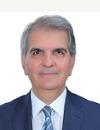
Prof. Ayad Mohammed Fadhil
Professor
at Tishk International University
|

|
|
|
|
Contact Details:
|
Sign In to send a private message or view contact details
|
|
Dr. Fadhil was born in Baghdad, Iraq. He received his B.Sc. Degree in Soil & Water Sci. and an M.Sc. Degree in Soil & Water Conservation from the Baghdad University, Iraq. He worked as A. Professor in the Institute of Technology in Al-Mussayiab, Iraq until 1999. He received a Ph.D. of Engineering Degree in the remote sensing & GIS from the China University of Geosciences, Wuhan, China in 2004. Between 2004 and 2007 he worked as an A. Professor of remote sensing & GIS at the Surveying Techniques Engineering Dept. in the Technical College of Baghdad, Iraq. Since February, 2007 he has been working as A. Professor of remote sensing & GIS in the Soil & Water Dept., College of Agriculture, Salahaddin University-Erbil, the Kurdistan region of Iraq. He was a Fulbright Visiting Scholar at the Center of Global Change & Earth Observation (CGCEO) in the Michigan State University (MSU) for the period from June to September of 2011. He has been promoted to Professor in June, 2012.
He supervised and examined more than forty postgraduate students (Ph.D & M.Sc. Levels) in the Iraqian and the international universities. His current research interests include the application of optical satellite data in monitoring, mapping and assessing land degradation, drought, desertification, soil erosion, soil degradation, soil salinity, sand dunes mapping, forest cover, forest fires, urban expansion, soil erosion, and environmental changes. More specific research interest: Satellite based images applications in land cover change detection, RS/GIS applications to detect, monitor and model the environmental changes, and digital soil mapping.
Upcoming Presentations
Most Recent |
Show All
|
Retrieving Data, please wait...
Publications
Most Recent |
Show All
|
Retrieving Data, please wait...
Conference Committee Involvement
Most Recent |
Show All
|
Retrieving Data, please wait...
Course Instructor
Most Recent |
Show All
|
Retrieving Data, please wait...
|

