How weather satellites have changed the view from up there
SPIE Classics looks at progress in weather satellite technology.
The world's first weather satellite, the Television Infrared Observation Satellite (TIROS-1) launched 57 years ago, 1 April, 1960. Weather satellites have changed how humans view the future, making it possible to foresee weather-related disasters before they arrive and better prepare for them.
The first images from TIROS-1 included blurry thick bands and clusters of clouds over the United States and a typhoon approximately 1,000 miles east of Australia. Since that time, scientists and engineers have continued to develop more sophisticated weather satellite and communications satellite technologies.

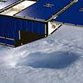
TIROS undergoes vibration testing at the Astro-Electronic Products Division of RCA in Princeton, New Jersey. Credit: NASA
As Hurricane Harvey has been inundating Texas with high winds and record-breaking rainfall, NASA has released a number of views of the hurricane from satellites such as the GOES-16 and the International Space Station (ISS).

Astronaut Randy Bresnik took this photo of Tropical Storm Harvey from the International Space Station on 28 August. Credits NASA
Floods caused by extreme precipitation are one of the most frequent and widespread natural hazards. As populations in urban areas grow and the global climate becomes more extreme and variable, flood events are becoming more costly and dangerous. Accurate precipitation monitoring is a key element for improving flood forecasting. Recent advances in satellite remote sensing techniques have enabled precipitation observation, which enables better flood forecasting and water resource management.

GOES-16 captured this geocolor image of Tropical Storm Harvey over the Gulf on 29 August. Credit: NASA
Urban planning, protection from natural hazards, precision farming, climate treaty verification, efficient airline and ship routing, energy use optimization, and access to natural resources all require reliable and detailed information about our planet's dynamic environment.
Advances in satellite technologies along with the ability to combine and analyze sensor information, and the communications tools for sharing this knowledge are helping address these challenges.
Related SPIE content:
 Optical instruments aboard GOES-16 weather satellite
GOES-16 is the newest NOAA-NASA weather satellite in geostationary orbit and will provide high-definition images and other data for weather forecasting, severe storm tracking, and meteorology research.
 A new generation of hurricane-observing satellites
A new NASA satellite mission will improve hurricane forecasting by making frequent measurements of ocean surface winds.
 Evaluating the impact of future remotely sensed data on hurricane prediction
Simulation technology that has greatly improved weather prediction is being expanded to assess the value of new observing systems for hurricane track and intensity forecasting.
 Advanced IR measurements improve hurricane forecasts
Water-vapor sounder data from NASA's Earth Observing System satellite Aqua facilitates significant improvements in hurricane-path and intensity predictions.
 STORM: a sounding and tracking observatory for regional meteorology
Increases in storm intensity and occurrence are demanding improved real-time sensors and prediction capabilities in storm forecasting.
 Effect of new radiance observations on numerical weather prediction models
The impact of humidity observations, from the Sounder for Atmospheric Profiling of Humidity in the Intertropics by Radiometry instrument, on an existing unified model assimilation system is investigated.
 Monitoring global precipitation using satellites
A multisatellite image-processing system can improve near-real-time precipitation measurement in remote, ungauged areas.
 Novel satellite instrumentation improves weather prediction and climate understanding
A NASA state-of-the-art, high-spectral-resolution, IR spectrometer has enabled significant progress toward improving numerical weather prediction and understanding climate processes.
 Bright future for remote sensing?
Increased demand, advanced technologies, and limited resources will all play roles in remote sensing's potentially sunny, but challenging, future.


